HIKING THE RUBY CREST TRAIL


(PART 4) HIKING THE RUBY CREST TRAIL
WITH LYNDA MELLOWS AND ROSANNE BAKER
LINKS TO ASSOCIATED PAGES:
View Photo Preview Page (1) || View Photo Preview Page (2) || Part 1 Trail to Liberty Pass and Beyond
Part 2 Other Wilderness Areas, Photos and Information || Part 2 Supplement Other Wilderness Areas, Photos and Information
Part 3 Outfitters, Pack Trips and Backpacking Guide Service
Part 3 Supplement Outfitters, Pack Trips, Thomas Canyon, Right Fork Canyon and Ruby Valley
Photo Page Hole in the Mountain--East Humboldts || Part 5 Birdeye Lake, Overland Lake, Lake Peak, Smith Lake, Clover Valley and Cave Creek
Part 6 Hiking Difficulty Comparison Chart || Part 7 C-47 and B-17 Military Aircraft Crash in the East Humboldts
Ruby Crest Trail...Nevada's Little Piece of Heaven
by Lynda Mellows
© Lynda Mellows and Rosanne Baker
Ruby Crest Trailhead, Lamoille Canyon
STARTING THE HIKE
Ahhhhhh.....Ruby Mountains.....Ruby Lake National Wildlife Refuge.....
There was just something about that name that tapped on my soul; or, was it the fact that I turned 40 years old this year, and I felt the need to seek the needs of my innermost self and conquer my goals. A little of both, and the fact that my 64 year old mother first enticed me with an offer that I couldn't refuse: a 40 mile hike from Lamoille Canyon to Harrison Pass, known as the Ruby Crest Trail.
On August 15, 2000 it became a reality. An exciting challenge to look forward to; yet within a 10 second period of engaging 40 pound packs on our backs, the true reality instantly flashed in my mind. My mother and I looked up Lamoille Canyon from where we had parked at the Roads End trailhead of the Lamoille Canyon Scenic Byway. The breathtaking scenery lends itself to rocky peaks, cirque basins, rolling sage and grass hillsides, steep narrow canyons, and, beyond our view, high glacial-formed lakes. I knew at that moment that this pack needed to become my best friend because it carried all of our essentials to survive. My next thought was towards my mother. I couldn't believe that she had accomplished this trek two years before and at age 64, carrying a 40 pound pack, had determination and motivation to put herself to the challenge again.
There had been numerous wildfires and considerable rain across Nevada this particular summer. If there were any lingering rainstorms, lightning could definitely be a concern when hiking at high altitudes above the tundra. For some reason, our timing couldn't have been more perfect. Crystal blue skies, temperatures forecasted to be in the upper 70's, lower 80's, and very little wind.
Return to top of page (or scroll to next section)
© Rosanne at Liberty Pass
10,450' Elevation
DAY 1, LAMOILLE CANYON TRAILHEAD
We turned around at the trailhead and waved good-bye to my stepfather. I will never forget the look on his face, and the smile he exhibited said it all. He was excited and happy for us, yet his expression spoke of concern and apprehension in wondering what the next four days would bring. He was to pick us up at Harrison Pass on Day 4, and knew all too well what terrain we were to cross as he had accompanied my mother on the same hike two years ago.
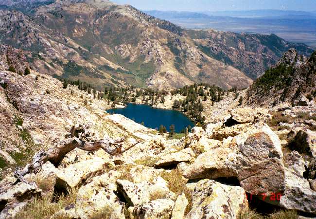
Day 1 took us through unbelievable scenery as we passed Dollar Lakes and Lamoille Lake, and then up to Liberty Pass at an elevation of 10,450'. We dropped down into Liberty Lake taking in the beauty of the indigo blue color of water and the steep mountainsides hovering above water's edge. It was at this point that we felt our hike was truly underway. Our descent took us by Favre Lake and down into the tributary of Favre Creek where we stopped to rest our feet.

© Descending to Liberty Lake
Mom took out moleskin and covered areas of her feet for precautionary measures, which, in hindsight, I should have done also. Water was limited this year since the snowfall wasn't abundant in the Rubies during the past winter and it was now August. That meant that we had to reach our destination everyday to ensure replenishing our lifeblood water. Our first stop was to be North Furlong Creek or Lake. The ranger had told us that there was no water at Furlong Creek and that we would have to hike down to the lake to filter our water. That gave us the incentive to keep our stride going that day and not take many breaks.
We climbed a range coming out of Favre Creek and dropped down into North Furlong Creek. Along the way we passed three men and two women backpackers. It was actually a welcome sight, seeing other human beings back in the wilderness on our first day. We all camped at Furlong Creek about one-half mile from each other. We made very good time, it was only 2:30 in the afternoon, and it felt so good to take the packs off.
We decided to set up camp since we knew our next day would be very difficult, a 12 mile stretch to Overland Lake which we would have to accomplish since it was our next water source. Our luck was good as we found two underground streams just down the trail that the ranger must have overlooked. At that point we did not really want to hike the additional distance down to North Furlong Lake to retrieve water.
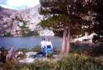
© All the Comforts of Home

First destinations are always exciting...it's the thrill of making it in good shape and knowing that you are on your way. We ate dehydrated Sweet and Sour Pork which mom cooked on our backpacking stove. She did a great job hooking up the fuel bottles and getting everything going. We ate at 4:30, cleaned up at the creek, filtered our water and replenished four canteens and two water bottles. That was a night that proved to be consistent with the rest of the nights--very little sleep, a lot of conversation and laughs, a little belly rumbling from all the trail mix and power bars, and a full moon.
In the middle of the night both mom and I were instantly startled and completed a 180 degree turn in our bags when we heard two piercing screams from an animal. Suddenly we heard it again down the canyon. It was a little unnerving and we kept the Counter Assault handy for such an event that might follow. We had even practiced target shooting before leaving home but at the last minute decided not to take a pistol.
Return to top of page (or scroll to next section)
© Leaving North Furlong for Overland Lake
DAY 2, NORTH FURLONG CREEK TO OVERLAND LAKE
We were up at the crack of dawn, rolled up all our bags, pad, tent etc. and ate breakfast of dehydrated granola and strawberries. The milk was a bit hard for me to stomach. It tasted like canned milk but mom thought it was delicious.
This day would be long and hard as it was our 12 mile trek to Overland Lake. We started in good time at 7:40 a.m. Deer were coming out of the aspens and we could see Wines Peak off in the distance which would take us to an elevation of 10,850'. It was at this time that I felt like we were hiking Mt. Everest. The switchbacks went on and on and the ranges roamed for miles.
This is where people normally see mountain goats and bighorn sheep. All we saw were prints. The trail is very narrow and crosses up and down numerous mountain ranges. You feel like you are on top of the world seeing vast countryside miles away from the peaks that you have climbed. It is an unbelievable experience to feel so free. At this point we were the sole human life on this trail.
We found ourselves taking several breaks as our heart rates were beating in overdrive in climb after climb. We took off our shoes and aired our feet several times. Our appetite quickly dwindled, and we found ourselves satisfied with an occasional stick of jerky, a powerbar for lunch, and a handful of trailmix in the afternoon. Warm water never tasted so good.
We figured that we would cross about seven mountain ranges to get to Overland Lake. This was a must since we needed to insure that we could replenish our water source. There really is no decent overnight camping place between Furlong and Overland unless you would like to pitch your tent on the trail or on a steep hillside with no close proximity to a stream or lake.
Half way through the climb we bumped into two bowhunters who had hiked in from the east side. They had found a place behind some trees to scout out their "hopefuls". I think they were a bit surprised to see two women coming up the range from the middle of nowhere. They wished us luck and told us to be careful as we continued along the hillside. We dropped down into Long Canyon and saw several tents set up in the valley amongst the trees and quickly figured out that it was prime bowhunter country.
Off in the distance, all we could see was a long skinny trail that meandered far beyond our knowledge. Yep, that was our trail. We climbed to the top and took a quick breather as the countryside looked like a storybook. We tried to capture this on film, but knew it would not tell the real tale. It will forever be etched upon my mind.

© Distant View of Overland Lake
We thought at this point that we had really made headway. We came around the bend to see more mountain ranges that were now steeper, more pronounced, more beautiful, and definitely rockier with beautiful aspens and wildflowers. I quickly said, "Mom, we probably have only a couple more miles to go" as the mountain ranges now looked as though they could definitely be the nesting grounds for Overland Lake.
We found a very large rock encircled by purple and yellow wildflowers and took off our packs. Our feet at this point were in dire need of a break and some reprieve. Our boots quickly came off and we pulled out the moleskin. It was time to tape and wrap my feet more substantially as I felt the wear of the extra weight from the pack. Mom and I were on cloud 9. Our cell phone quickly came out and we phoned down to the Ranch where my stepsister lives near the Ruby Marshes. The phone worked and we let everyone know we were O.K. and bragged about getting to our destination in such good time..."ONLY A COUPLE MORE MILES".
We were wrong. Looks are very deceiving. You can't just get over to that mountain range where you know Overland Lake lies. Turning the next corner proved it plain and simple. There were many more hillsides to cover and the small skinny trail resembled an echo carrying itself down a canyonside. We had been hiking since 7:40 a.m. and by 4:30 p.m. my feet had finally succumbed to the inevitable--blisters. Mom was holding up great. Her boots were somewhat forgiving with ample room for a good sock but mine were more form fitting. They hugged the top of my foot like a tight fitting glove. I suddenly found out that this was not the best shoe choice. They were great for day hikes but not for extended miles on end with the added weight of a 40 pound pack and with the sun beating down relentlessly from sunup to sundown.
This scenario made a perfect environment for swelling of the feet. Gosh, if I would have just chosen that half size bigger in the shoe department. I toiled emphatically over that decision. You win some, you loose some, but no time to give up because there is no alternative. Overland Lake was still out there somewhere--right around the corner? We thought the same thing several hours ago and are now wondering what crest will come into view around the next corner.
We could see the trail wrap itself around the sides of several ranges and knew that we had to keep one step in front of the other. Our happy-go-lucky chatter and small talk became still as we were both growing tired and exhausted. With every step, my feet came to the forefront of my thoughts. We suddenly found ourselves in mountain lion country, clearly evident by numerous paw prints in the thick dusty dirt of the trail. They were so thick in this particular area that you literally could not step six inches without seeing another print. Even though this was terribly eerie, it was probably somewhat of a blessing for me since it took my mind off my feet. I found the strength to move ahead while constantly anticipating what my feet would look like at the destination point.
There were hordes of aspen trees to our left in the valley and large tall rock formations to the right with perfect holes for beady eyes. It was now getting dusk and deer were coming out of the aspens. Our silence told the story about what was on our minds but to our relief we never did see any mountain lions.
We came to a crossroads where the trail veered in two directions--one straight up and the other to the left. One last climb to the top and we prayed there would lie Overland Lake. We were assured of this by two men who yelled to us from the top. I will never forget the beauty of that Lake when it came into view; it was truly a piece of heaven with an indigo blue all its own. We had made it and there were several groups of horses and men camped there for the night.
© Finally, at Overland Lake
It was bowhunting season. I was actually relieved knowing that the horses were near so that I wouldn't have to worry about mountain lions. Most people say that they stay away from you, but the terrain we had just crossed left a feeling of uneasiness that could not be comforted by statistics.
That night was grand. Mom catered to me as she always did as a child, fixing me a dinner of spicy chicken. She capped it off with a mug of hot chocolate that never tasted so good. The lake proved to be the best reprieve for our dirty, salty bodies and tired hurt feet. We laid out all of our necessities for the evening--motrin, aspirin, sleeping pills, counter assault spray, and a flashlight. You bet, we took them all.
Thanks to the sleeping pills I got several hours sleep that night. High altitude keeps you wired and mom had warned me about sleepless nights at these elevations. After the night at Furlong, getting no sleep at all, I desperately needed a rest that would prepare me for the trek in the morning. Those sleeping pills didn't work so well for mom; it must have been a long night for her.
Return to top of page (or scroll to next section)

© Fairwell to Overland Lake
DAY 3, OVERLAND LAKE TO MCCUTCHEON CREEK
Mornings always come with a vengeance. Our energy levels are rejuvenated and we are raring to go at the crack of dawn. I felt elated that we had the tough day behind us, and I carefully planned and executed the art of "blister bandaging". Thank God for moleskin of all sizes. Our climb out of Overland was tough. Straight up, switch backs and solid rock. It took us some time to get to the top, but we decided to take it a little easier and enjoy the day. Besides, one must stop to look back at the impressive lake that God so graciously laid upon this land. It was beautiful, and I quickly thought about my husband and how much he would have enjoyed this place.
Upon reaching the top, we stopped to chat with a bowhunter who was hiking in to try a little fishing. He had shot his deer the day before and had heard about Overland. He gave us words of encouragement and we were on our way. This 3rd day proved to be tough as well. We hiked over the 10,160 ft. pass above Overland Lake and crossed the divide into the Smith Creek drainage. We descended to 7,920 ft. while crossing Smith Creek's North, Middle and South forks. They were quite a distance apart from each other. The ascent from the South Fork proved to be long and tough climbing over a dividing ridge at 9,340 ft. This was the point of no return for my feet. I was in agony. All I could do was look up and see the top continuing into space, and then look below at the vast rolling valleys amongst the mountain ranges, and wonder how I could muster up the strength to forge ahead.
© Leaving Overland Lake Area

It was hot and dry and the pain was excruciating as we gained 1400 feet of elevation. I had to stop at the top to take off my pack and ultimately my shoes. I now had 13 blisters, including two on the bottom of my little toes that were very deep and oozing. My tears came through like a flood gate. I prayed, I sobbed, and I spoke some ill words. It was a frustration like nothing I had ever experienced. My legs and heart were strong, and even though the weight of the pack was heavy and straining at times, my feet were my enemy. All those days of running six miles at home couldn't prepare me for the stress I had toiled and the shoes I had chosen.
McCutcheon Creek drainage was our next destination point. We had to march on. Another mile and a half would probably get us to the old sheep camp at the creek at 8,760 ft. Mom trudged on to find the camp, and I walked as though there were hot coals beneath my feet. My mind took over and I simply continued onward, refusing to give up, but saying the lords prayer and swearing at the same time. Luckily, mom has a very thick skin and nothing seems to shake her spirit very much. She marched on like a champ even though I know the weight of her pack was unbearable. Her complaints were silent and it was then that I knew what I had always known all along. Mom had determination, strength, motivation and will like no one else I'd known. She could laugh at the smallest of things, yet stand firm in the most difficult. I did not want to let her down, nor myself.

© McCutcheon Creek Area
We were so tired that we decided to forego dinner. Another powerbar would somehow suffice...ugh, but it sure beat yesterday's breakfast of dehydrated eggs. You can cook them to death, but the "rawness" never quite leaves. They look undercooked and taste somewhat raw but I never told Mom that until she offered to cook eggs again. This time, Mexican eggs, and I had to tell her that I had pitched mine the morning before. Mom pitched the tent and filtered our water, and I soaked my feet in the creek. All the duties were left unto her that night because she insisted. I didn't hesitate taking her up on any of it either.
That night I drained all of my blisters and used the antiseptic ointment from the first aide kit. Finding things in there to really doctor my feet in the morning, I was determined to make it out on my own. That night was another full moon and we found ourselves talking for hours and once again finding it hard to sleep. Funny how your mind wanders in the night. Thank goodness we found our laugh again. I apologized to mom for my unhappy sentiments on the trail and her response was, "I thought it to be quite refreshing to see it Lynda, I thought you had turned into a saint". Only a mom could love you in any state of mind.
We had a brainstorm in the middle of the night. It suddenly dawned on us that we wore the same size shoe. I would wear mom's shoes out of McCutcheon Creek in the morning, and she would wear mine. That might give me just the reprieve I needed. I took a deep breath of relief thinking we had a plan. Mom tried one shoe on in the morning and gasped for air wondering how in the heck I even wore the boots. They were too form fitting and she said there was no way she could wear them. Oh well, I didn't have a choice.
Return to top of page (or scroll to next section)
DAY 4, LEAVING MCCUTCHEON CREEK TOWARDS HARRISON PASS
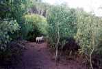
The trail out of McCutcheon Creek contours along the West and South slopes of Green Mountain which is thick with Aspen trees. You feel like you are encased in a jungle of Aspen groves with no visible view except for the trail. Many a tree is etched with graffiti. The sound of domestic sheep cry out in every direction. It was just a matter of time before we spotted some sheep on the trail gazing at our presence. We saw numerous animal prints on the trail--sheep, bobcat, deer, raccoon and the like. The top of Green Mountain hosted the sheepherder's camp, outfitted with a white wall tent and a few supplies.
© Sharing the Trail
The mountain ranges were getting more gradual, and we could tell that we were going to start our final descent into Harrison Pass. What a thrill and I got a second wind. My mind took over once again, and I hummed songs to keep my mind elsewhere. That only worked for so long until I needed to take a break. At that point, mom insisted I wear her shoes and the trade was on. She bandaged her feet for protection and off we went. Mom's boots were better, but at the state my feet were in, nothing felt like a velvet slipper. I think it was her orthopedics that was the saving grace. They lifted my foot up to a different position.
The trail had now turned into a road, and it was a clear sign that we were on our way to Harrison Pass. We came upon a group of guys called "The Clampers" who, in four trucks, were four-wheeling up the road. Their mission is to check out different areas and terrain. Our ride home was to pick us up at the gate on Harrison Pass, and we quickly asked the guys how much farther it was to the gate. The response was 1 1/2 to 2 miles. Wow! Did that give me a boost! Our strides got a little quicker and the elation started setting in.
Return to top of page (or scroll to next section)
AN UNNEEDED DETOUR
You could see the valley with three roads all leading in the same direction, but miles apart. I turned to mom and said, "Gosh, do we have to go clear up to that high road?" (as it wound way off into the distance and was the farthest away). She quickly responded "No", as she had remembered it from the last trip. There was a very large rock formation off to the right, and mom thought that was the rock where they ended up two years earlier. We followed the truck tracks that lead towards the rock and felt that we were in luck. We followed the road down the canyon and, well, it just dead-ended. What the heck? We will just cross the valley and climb the other side to reach the road because we knew it had to be there.
That valley was a swamp with a herd of cattle and one BULL. Gosh, we have made it clear across the Ruby Crest Trail with no incidents or detours and now we can't get across the swamp and wouldn't it be ironic if we got speared by a BULL? After several minutes of contemplation, mom once again came to the rescue and found a crossing down the way. We climbed over the ridge and started down to "that" road by the rock. That rock was NOT the rock after all and the road again dead-ended. My feet were not happy; nor was I. Bushwhacking it was.
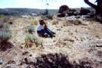
We remembered from the trail above that there were three roads, and I knew the vicinity of the other one. Again we trekked through the hillsides, and crossed another water source before reaching the other road. We walked and walked until this road too came to a dead end. The strength in my arms was unreal as my pack sailed off my back in record speed and flew into the side of a tree. I felt myself finally wanting to give up. I had hiked for hours on feet that most people wouldn't walk on from their living room to their kitchen sink.
© Lynda About Ready to Throw in the Towel
We had come out of Green Mountain onto Harrison Pass at 11:30 a.m. and it was now around 3:15. We had unnecessarily detoured for almost four hours. We finally realized that we had better use our compass and simply head south. Our best bet was to get back to our original destination coming out of the trail. It was a steep climb back up the canyon and we were breathing hard. It was hot and our canteens were almost empty. If nothing else, we would get to the road and sit there and wait since we knew our ride would eventually come up this road.
Far off in the distance to our east was that high road that meandered the crest of another ridge. That was the road I had originally asked mom about. It was Harrison Pass and had we simply stayed on the original road coming out of the trail earlier that day, we would have found "the gate", that pot of gold at the end of the rainbow. In hindsight, following the lead from the guys in the trucks and their tire tracks proved to be a bad idea. A compass is your only true friend, but I think the elation of almost reaching the end took precedence over our common sense strategy. The terrain just looked too easy as all three roads seemed likely to channel down to the same vicinity.
As we climbed the steep road back up the canyon, I kept my eyes focused on what we now knew was Harrison Pass way off in the distance. I knew that Gene, my stepfather, would be coming to look for us because my mother had used our cell phone in McCutcheon Creek to phone down to the ranch the night before. It was unbelievable that it even worked as we were nestled miles up in the valley of a canyon. Must have been a perfect range for the cell. Mom left a message that my feet were in poor shape and it may be difficult for me to make it out. I knew that Gene would four-wheel up the road as far as possible. At this point, it wasn't that I couldn't make it out, but the problem now was to figure out how to get back on track.
Return to top of page (or scroll to next section)
LUCKY PENNY AND HOPE IS IN SIGHT
We must have put on five miles in the canyon, and at this point my occasional tears from pain subsided and I simply entered a different mind-zone. I can't explain it; I just kept climbing knowing that I wasn't going to surrender to my feet or exhaustion at this point. I looked down and in the middle of nowhere found an old dark penny and a nickel in the dirt, obviously weathered from the elements. The penny's head was up and luck was all that I felt. I quickly picked them up and stuck them in my pocket.
My focus continued to watch that pass way off in the distance. It was only several minutes later that I saw a white truck driving slowly along the crest. I knew it was Gene as the entire mountain range and valley had been desolate with no signs of human life. It isn't exactly a place where you sit by the road and wait for someone to come along for a ride. I looked at Mom and told her to come along the best she could, and I buried my head to the ground and took off at a pace that would do justice to a mediocre jogger.
Considering the road was straight up, the condition of my feet, and the heat of the sun, it was amazing that I could focus on what needed to be done. I left mom in the dust and headed for the high road. Here came the truck and I knew it was going to be tight meeting it dead on. I bellowed my two-fingered whistle six or seven times, but Gene's focus was on the road and no whistle of any kind could snare his attention. The noise from the diesel took precedence and his windows were rolled up. If he had only looked to his left he would have seen me. Mom was waving her flannel shirt like a helicopter blade in the air, and I thought anyone would be able to see my vivid sky blue backpack towering above my body.
Return to top of page (or scroll to next section)
DISAPPOINTMENT
My eyes simply followed the back end of the Ford, watching it slowly creep up the road and out of sight. I was only minutes from meeting it head on. In hindsight, I should have thrown my pack on the hill and put my jogging skills into action. That would have landed me face to face with our ride, and I know I could have done it. Mom caught up with me at the road and it was a relief for both of us to be at the top once again. Our packs came off, our shoes came off, and mom quickly laid down on the dirt road resting her head on the rolled up pad on her pack.
The heat and the workout, not to mention the mental anguish, had taken its toll. Mom felt queasy and dehydrated, and I worried about her lungs and heart since all her life she has toiled with asthma and allergies. Her inhaler was her companion the entire trip, but one would never know that this lady was 64 years old. I found myself trying to remember that. Mom told me to stay put and wait it out. Gene had no way out but to turn around at some point and come back.
I have always had a streak of German stubbornness and persistence. It came out well here. While mom was resting, I hiked up the road in my bare socks and found myself back in the hovering aspen trees. I was afraid that Gene would get to the end of the road and wait for hours looking for some sign of us coming out from the trail.
© Lynda and Gene near Harrison Pass
But low and behold I heard the sound of a diesel. As you know the annoyance of a diesel, I can say it never sounded so good. It was Gene. He couldn't believe that I was on the trail, and I remember anticipating the handle of that truck door. How good it would feel to lift up the latch and climb onto that seat. A feeling of jubilation filled my entire soul.
Return to top of page (or scroll to next section)
FINALLY, HARRISON PASS
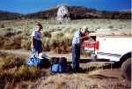
© Dry, dusty and not so very scenic scenery where the Harrison-Lamoille trail joins the Harrsion Pass road
Luckily Gene had been a Boy Scout years ago. His keen sense of his surroundings and Boy Scout knowledge brought him back within an hour or two. He had parked his truck at the end of the road and hiked up the trail looking for our boot tracks. Mom had a pair of hiking boots with a distinct alligator looking imprint on the rubber soles. Gene had paid attention to these sole markings some weeks earlier, and he could see where our tracks came out and ended. The only thing Gene could imagine was that we had rode out with someone else.
We quickly scurried down the road to find mom. The reunion was all smiles, filled with a waiting ice chest of cold drinks and a hug or two. Now we were off to reach that gate we so longed to see.
During that truck ride, I thought about Matt Brown. He was a young ranger whom we met in Lamoille Canyon at camp. Matt hunted us down as he had heard that we were going to hike the Ruby Crest Trail, and he had information regarding the water and terrain. He claimed that he had hiked the 40 mile trek in one day with a gallon of water on his back. At the time, I thought, "Wow...that's unbelievable", but didn't think much more about it. However, I must confess that after accomplishing this task myself, I began to chuckle, wondering what continent he came from. Being a runner myself, I couldn't imagine that even the talent from Kenya could so nonchalantly master this task. At least it gave my mother and myself something to snicker about from time to time.
Waiting at the top of the pass was my husband Mike and my youngest son Colten. Mike and Colten had driven up the pass in a camper van and met Gene that afternoon before the search started. Mike and Colten decided to stay put as our dog Ruby was with them and the truck would only comfortably fit mom and me in the front with no room for anyone else. There was no space in the back of the truck, as it was covered with an anchored sheet of plywood used as a platform for their two four-wheelers. It was three hours later that we finally arrived.
It was a feeling of so many emotions at once: The sense of elation that we accomplished our mission and that I found the strength to make it out on my own. The feelings of gratitude for each of our family members and the wisdom to really know what they mean to us. And the fact that we were safe and could get a good nights sleep, and my feet could now find a place to recover.

© Rested up and Ready to go Again
I cannot tell you how important it is to set challenges and goals for yourself no matter what age you may be. My mother was the epitome of that statement. I also know that life deals us challenges that are completely unforeseeable, but it is through persistence, determination and focus that we can come out on top. The Ruby Mountain Crest Trail will forever hold memories in my heart and mind for the rest of my life. The climb can test your soul, but the rewards are immeasurable. It is Nevada's little piece of heaven.
Some people kept telling us we were crazy, but there was something out there that kept telling me we weren't. Besides, it was in the cards: 40 miles, 40 pound packs, 40 and 64 years old, 4 days and all "4" the love of wanting to do it.
Return to top of page
Email correspondence to Ruby Mountains Express
I respond to all emails
Search This Site With: www.atomz.com to Identify Pages that Contain Subject Matter of Interest.
Use of the "Exact Phrase" option is usually recommended in order to avoid most non-relevant hits. Set Within: to 'Anywhere' in order to also include text captions on photos. Hits on the search terms will provide links to the page(s) where the text is located along with text summaries. The summaries should help identify the pages with the desired information.
The search engine identifies exact text (or almost exact text) and not concepts. For example, to find photos of North Furlong Lake (or anything else), do not search for 'photos of North Furlong Lake'. Instead, search for 'North Furlong Lake' which will identify pages containing that text and most or all identified pages will usually have the related photos.
Part 1, Trail to Liberty Pass and Beyond
Part 2, Other Wilderness Areas
Part 2 Supplement, Other Wilderness Areas, Photos and Information
Part 3, Outfitters and Pack Trips
Part 3 Supplement, Outfitters, Pack Trips, Thomas Canyon, Right Fork Canyon and Ruby Valley
Part 5, Birdeye Lake, Overland Lake, Lake Peak, Smith Lake, Clover Valley and Cave Creek
Part 6, Hiking Difficulty Comparison Chart
Part 7, C-47 and B-17 Military Aircraft Crash in the East Humboldt Mountain Range


