HIKING THE RUBY MOUNTAINS--TAKING POSTCARD PHOTOS (PART 2 SUPPLEMENT)


MAKING POSTCARDS FROM MOUNTAIN PHOTOS
This site consisting of several pages is the most comprehensive and informative site on the internet relating to hiking and horse treks into the unique glacier formed Ruby Mountains in Northeastern Nevada. Numerous alpine lakes and related scenic images are shown throughout. Consider having postcards or brochures printed by using any image on this site, or of course your own. Images for postcards are uploaded to
Printing Postcards Twenty-five 4x6 cards are reasonably priced starting at $4.60. Numerous other products are available.
SOLDIER BASIN
DIRECTIONS TO SOLDIER CANYON FROM LAMOILLE
The drive to Soldier Canyon from Elko can be made through Halleck from I-80, or through Lamoille from SR 227 (Lamoille highway). The route through Lamoille is somewhat more direct and is recommended. Drive straight through Lamoille to the Crossroads where the rather famous white Presbyterian steepled church will be on the right. Turn left and at about one-quarter mile make a ninety degree turn to the right.
Follow the gravel and oiled road nine miles to the turnoff leading to Soldier Canyon. The only junction along the way will be to Lower Lamoille Road but keep going straight. The turnoff to the canyon is identified by an inconspicuous
4" x 24" sign on the left side of the road saying "Soldier Creek". Turn right on the one lane dirt, dusty and somewhat washboarded road into the canyon. The road crosses private property for about the first two miles, albeit just sagebrush.
After crossing a cattle guard and entering the National Forest area, the road will continue about two more miles into Soldier Canyon to the trailhead. Two cars could not pass at many places along this road and if meeting an oncoming car, one vehicle may have to back up a considerable distance to a passing spot. Unless pulling a horse trailer, the uphill bound car normally backs down but the grade is very mild, almost flat. The road is certainly not a 4-WD road but the vehicle will accumulate more than its share of dirt and dust. The road will come to a creek crossing (Soldier Creek) where there is parking space for about a dozen or so vehicles.
TRAIL DESCRIPTION
Soldier Creek is usually ten to twelve feet wide, but shallow, at the crossing that will require wading in order to begin the hike. The trail starts out on the continuation of the road when it used to go further up the canyon. One or two large boulders at the creek crossing now prevent vehicles from crossing. At one time you could cross the creek, even with a 2WD vehicle, but the rocks were probably placed there intentionally to prevent vehicles from possibly getting stuck or for lack of parking space further up the road. The road continues for about a quarter mile where the trail then takes over and enters aspens that almost completely enclose the trail. This will contribute to pleasant hiking at the beginning. Soldier Creek is off to the right.
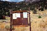
© Soldier Basin Trailhead Sign
Soldier Canyon is very narrow which eliminates the possibility of any switchbacks along the very rocky trail and the trail has no choice but to follow the steepness of the canyon. The canyon then begins to make a sweeping ninety degree turn to the right. To make the rough and rocky trail a little more delightful, mud will be added here and there from springs running across the trail. After a while you are looking forward to breaking out of the canyon and eventually there seems to be hope in sight. A "V" of sunlight up ahead signals the end of the canyon and the trail eventually breaks out of the canyon into sunlight.

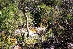
© Views of Soldier Creek Through Canyon

© Section of Rocky & Steep Trail Through Canyon
The trail empties from the canyon into sort of a meadow (Soldier Basin) and almost flattens out. The hiking is very easy but there are no longer trees along the trail which might be desirable for some shade. The only patches of trees are now up on the hillsides. There are about two more miles of easy hiking to the lakes in the open sunlight. A feeling of extreme dryness may set in, creating a desire to be back in the canyon for relief.
© Hillside View from Soldier Basin & Looking Back Towards Canyon from the Basin
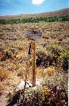
© Trail Sign to Ruby Valley
By staying on the main trail, the first lake(s) you will come to will be the Soldier Lake group consisting of five or six rather small ponds. Probably no single pond deserves to be called a lake. While Brook trout could probably survive in the largest pond, they are not known for fishing.
Before reaching the Soldier Lake group, you could turn off the main trail to the right for the trail to Hidden Lakes (see Part 2 for specific instructions for finding this trail). Hidden Lakes have some rather large Cutthroat trout that will challenge your fishing expertise. Due to shallowness near the shores, you can wade some distance into the lakes for fishing.

Upper Hidden Lake

© Lower Hidden Lake
Robinson Lake is a little further up the trail from Soldier but can also be reached from the continuation of the trail from Hidden. Robinson is generally the primary fishing lake of the group and it may be a little hard to imagine that it is only six feet deep or so.

© Robinson Lake
Wade out to the rock shown on the right side of the photo for fishing.
Return to top of Page (or scroll to next section)
SEITZ AND GRISWOLD LAKES
SEITZ LAKE
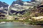
© Seitz Lake
The former easy approach to the Seitz Lake trail is no longer available. From the road leading into Lamoille Canyon, the road branching off to the right leading into the Ruby Dome Ranch used to skirt the base of the mountain to Seitz Canyon. From there the trail starting up Seitz Canyon could be easily accessed.
Specific directions leading into Seitz and Hennen canyons from Pleasant Valley Road off the Lamoille Highway are given in the Seitz and Griswold Lakes section of Part 2 Other Wilderness Areas, Photos and Information. This requires obtaining a key from the Spring Creek Association office located at 451 Spring Creek Parkway which intersects the Lamoille Road on the way to Lamoille Canyon. After obtaining a key and proceeding through the locked gate off Pleasant Valley Road, the road into Hennen Canyon branches off to the right while the road towards Seitz Canyon continues straight ahead to a rifle range. From there a 4WD vehicle can make it to the top of the ridge to the left of the rifle range which overlooks Seitz Canyon. Or, start hiking from the rifle range.

Cows Roaming the Shooting Range
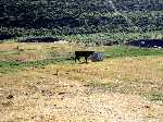
© Cow Approaching Target Frame
Ten seconds later the cow knocked over the target frame.

© 4WD Road Leading to ridge above Seitz Canyon
This road branches off to the left about 200 yards before arriving at the rifle range.
Drive or hike to the ridge and then descend into Seitz Canyon on the other side to find the trail. The trail starts out as an old road that goes a short ways up the canyon, but beyond that point the trail is not maintained and will be overgrown with aspens, difficult to follow, and even become lost in places. The trail, however, follows the left side of the narrow canyon and even if lost in places, can usually be found again without difficulty. At least two beaver ponds are along side the trail and, if early in the season with high water, may require wading through rather than trying to go around.
One of the most difficult sections of trail, when accessing the first of two high shelves, is a straight up stretch next to the canyon wall that is steep with no switchbacks. However, this section is less than 200 yards in length. Above this first shelf the aspens will thin out and disappear and the trail now consists of rocks and low brush with typically loose footing. The trail continues to gain altitude towards a second shelf until you are actually above, but still some distance from the lake. Topo maps show switchbacks along this upper portion of trail but in reality they are very short, steep and indistinct. Finally a mild descent and you are there. Seitz Lake is more of a large, shallow pond and does not contain fish. However, the head of Seitz Canyon on the far side of the lake is unusual and scenic.
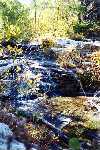
© Waterfall Along Trail to Seitz Lake

© Seitz Lake
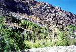

© Stand of White Firs in Seitz Canyon & View of Seitz Canyon from Ridge Above Rifle Range
The White Firs shown in the above photo is the only stand of White Firs in the Ruby Mountains.
Additional photos and trail information can be found in the Seitz Lake sections of Part 2 Other Wilderness Areas, Photos and Information and Part 3 Outfitters, Pack Trips and Backpacking Guide Service.
GRISWOLD LAKE
The Griswold Lake and Ruby Dome trailhead sign indicates three miles to the lake and six miles to Ruby Dome. Start the hike on a well defined trail in the sagebrush by crossing Butterfield Creek from right to left. The trail will immediately start to gain some altitude but some distance after a fence crossing through a gate, the trail will start to level out and enter the aspens above Butterfield Creek. A mile or so up the trail, a trail will branch off to the right and cross Butterfield Creek, but continue on the trail up the left side of the canyon. (See the following section, The Creek Crossing to Hell, for a description of the trail branching to the right.) The hiking up the left side of the canyon continues to be pleasant for some distance through the aspens and cottonwood trees.
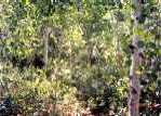
© Pleasant Hiking Through Aspens
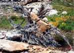
© Object-de-Art
The thing you hear most about the trail to Griswold is that there is no trail when you start getting close to the lake and that you have to make your way over, through and around rocks. About three-quarters of a mile from the lake the trail does start to fade and rocky conditions start to develop. This is a preview of things to come.

© Rocky Section of Trail
As you get closer to the lake the rocky conditions take on more meaning as you are constantly stepping on, around and walking across sheer rocks of all shapes and sizes. You must closely watch your footing to keep from twisting an ankle or worse. However, it is not as bad as might be imagined. By paying close attention to the trail markings, the cairns (piles of rocks) will keep you guided along the "trail". Try to follow the cairns rather than forging a route of your own. The thing that makes it somewhat forgiving is that the steepness of this rocky terrain is not that overwhelming.

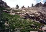
© Rocky Sections of Trail Approaching Lake
The approach to the lake is rather deceptive as you are constantly trying to guess the lake's location. Scrambling up and over rocks, you know that the lake just has to be beyond the next tree line or just over or around the next granite shelf but you are almost always wrong. Finally, when you are just about to run out of canyon, and there are no more shelves to climb or go around, the terrain will flatten out and after a short, easy walk you are there. The lake sits in a typical and very scenic granite basin.
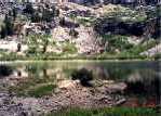
© Griswold Lake

© Pleasant Valley from Canyon
Follow the cairns to get back down the rock pile.
THE CREEK CROSSING TO HELL
(On the way to Griswold Lake)
The trail to Griswold Lake is up the left side of the canyon to the left of Butterfield Creek, but about a mile from the trailhead the trail branches to the right and crosses Butterfield creek on the right. During another hike, the trail crossing the creek was more distinct than the trail continuing up the left side of the canyon so we thought we would try the creek crossing. This was a hugh mistake and we eventually had to give up out of sheer frustration as the trail disappeared into a thick growth of downed aspens. The trail continues into the aspen growth for a ways but then just vanishes. At that point you think you might be seeing remnants of several different trails leading in different directions. Various approaches were attempted from that point but each one just led into dense thickets of downed aspens and we were unable to proceed beyond a certain point.
We got as far as an old sign on a tree saying "Griswold Canyon", but continuing past that point required more luck than we had that day. We thought we could fight our way through without that much difficulty, but after backtracking several times and trying new approaches, we would continue to come up against walls of downed aspen and tangled underbrush, and gave up the effort. It's impossible to tell whether you might get through this mess in the next 100 yards or the next half mile.
We weren't able to backtrack the "trail" leading back out of the canyon and getting out wasn't all that much fun either. We came across a small clearing in the undergrowth that contained the rusty remains of an old shovel and several moldy and disintegrated pieces of clothing including a yellow rain slicker.

© Griswold Canyon Sign
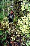
© Where to From Here?

© Climbing out of the Canyon Through the Aspen Thicket
At least this was an interesting side excursion.
This link provides a good overhead view of Griswold Lake: Griswold Lake Photo.
Return to top of Page (or scroll to next section)
AREA MAP
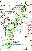
Map Displaying Lake Locations and Other Geographic Features
Click the map image to expand to full size (file size is 279k so loading time may be slow). The map will show the locations of many features mentioned on these pages. Included are the communities of Elko, Wells, Deeth, Jiggs, Lee, Lamoille and Spring Creek. Some geographic features shown are Ruby Valley, Secret Pass, Harrison Pass, the Ruby Marshes (Ruby Lake National Wildlife Refuge), and Lamoille Canyon. Relative positions are shown for all named lakes in the Ruby Mountains and East Humboldts as well as some other major canyons. To prevent over-crowding, the distances apart are not exactly to scale.
VERDI LAKE & "TRAIL" PHOTOS
 © Verdi Lake
 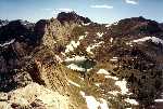 © Verdi Lake & Verdi Peak
Above photos courtesy of William E. Johnson.
© Photos Taken During Climb Towards Verdi Ridge

© Terraces Picnic Area
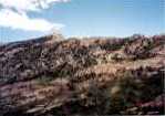
© Cliffs Behind Terraces
Go to Part 3 Supplement at this site for Verdi Lake trail and access information.
Return to top of Page (or scroll to next section)
WINCHELL LAKE & TRAIL PHOTOS
The trail to Winchell Lake is easy to follow and alternates between open hillsides and through dense aspens and foliage with a creek crossing or two. The overall elevation gain is minimal since the trail starts from a high elevation just a short distance below Angel Lake. (See Part 2 for explicit directions to the Winchell Lake trailhead.)


© Cliffs Above Trail to Winchell Lake
© Sections of Trail Through Rocky Terrain, Foliage, Open Country and Through Cone Flowers.
The trail passes some former beaver pond activity in one or two places but apparent loss of water caused the beavers to move on to other locations.


© Old Beaver Pond Activity Along Trail
 © Winchell Lake
  © Angel Lake
Return to top of Page (or scroll to next section)
LOST LAKE
To get to Lost Lake you must really, really want to get there. There are two main obstacles: 1) finding out how to get there, and 2) getting there once you may have found a way. This lake is the least viewed lake in the Ruby Mountains. Birdeye Lake holds the same distinction in the East Humboldts.
Lost Lake, located on a steep, rocky ledge on the west side of the range near the head of Rattlesnake Canyon, is about three miles crow flying distance from Overland Lake. This suggests that you could get there from Overland Lake. This is one possible route but you must first get to Overland, either from the Ruby Valley trail or by hiking in from either end of the Ruby Crest trail.
Once at Overland you are pretty much on your own. There is no direct trail all the way to Lost Lake but the best bet would be to take the Crest trail south out of Overland until reaching the east-west divide on the ridge overlooking Gennette Creek Canyon. At that point leave the trail rather than lose altitude by following the trail down, and then try working your way north (to the right) around the head of Gennette Creek Canyon and see if you can make it to the ridge separating Gennette Creek and Rattlesnake canyons.
If successful, looking down from the ridge you will be viewing a lake which has the shape of the state of California. There is a pond at the upper end. If you want to descend to the lake, it is a steep and treacherous scramble over loose rocks. This should be a prime bighorn sheep and mountain goat spotting area. Now and then the Forest Service has indicated that they might plant fish in the lake but who would come around to do any fishing?
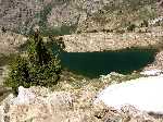
© Lost Lake

© Pond at Upper End of Lake
Another way that could be tried is through Lee. Rattlesnake Canyon is the largest canyon on that side of the range and is easy to recognize. But like going to Echo Canyon, the road to Rattlesnake Canyon passes through reservation land and requires paying the access fee.
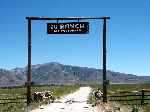
© 2U Ranch Entrance
Mouth of Rattlesnake Canyon visible behind left sign pole.
First stop at or telephone the Reservation Travel Office at Lee (775-744-4273) to make the necessary arrangements. To find the canyon, continue a mile or so passed Lee until coming to the entrance to the 2U ranch. The road into the ranch heads directly towards Rattlesnake Canyon. Someone from the Travel Office will probably accompany you into the area. Once in the canyon, hike to the upper end and the lake will be on the high shelf on the right. Topo maps show a trail leading up the canyon but don't expect it to be at all maintained.

© Rattlesnake Canyon from SR 228 to Harrison Pass
BOX CANYON RIDGE
One overlooked but easily accessible destination that provides great views is the hike/climb to the ridge that separates Lamoille Lake and Box Canyon. The distance is about the same as the hike to Lamoille Lake via the hiker trail but somewhat more difficult due to the necessity of making an off-trail climb to the ridge from the stock trail. From the parking lot at the end of Lamoille Canyon, start out on the stock trail along the right side of the canyon rather than the hiker trail that starts out up the center of the canyon. The stock trail starts to gain altitude immediately through a series of easy navigable switchbacks. Liberty Pass is clearly visible up and off to the left.

Liberty Pass from Trail
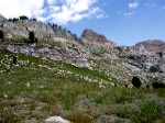
Snow Lake Peak from Trail
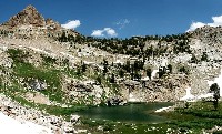
Snow Lake Below Snow Lake Peak
The high, pyramidal shaped peak up and off to the right of the trail (center photo above) is Snow Lake Peak. Snow Lake, like the neighboring Box Lake (see below), is also not officially named and is located on the opposite side of the ridge at the head of Box Canyon. It acquired the unofficial name Snow Lake due to being covered with ice and snow for much of the season. Ironically however, Snow Lake Peak is officially named and acquired its name due to its location above "Snow Lake".
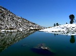
Snow Lake Living up to its Name (photos by Travis Munster)

At the end of the last switchback the trail will start veering off to the left. At that point leave the trail and continue making your way forward up the gentle sloping hillside off to the right of the trail. A short distance later the first view of Lamoille Lake will appear off to the left.

Leave Trail After Switchbacks
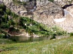
Lamoille Lake Comes into View
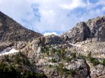
Close View of Liberty Pass
Continuing to sidehill upward, the hillside becomes a little steeper and increases to almost a 45 degree sidehill angle. The terrain remains cooperative for a ways, consisting mostly of low vegetation and small rocks but loose and slippery footing. Further along, the climb turns into a guessing game or two, deciding whether to go below or above large rock outcroppings or patches of willows too high to walk through. Higher up the hillside, the more of Lamoille Lake will be seen below until it’s almost in complete view.

Lamoille Lake Almost in Full View

Typical Rocks and Low Shrubbery Along the Hillside
The destination on the ridge can be seen from some distance away before actually arriving there. One landmark to look for is the rock shown on the ridge in the below left photo. At that point the destination is only 100 yards or so away. When directly below this large rack, start makine a bee-line upward to the low point in the ridge for the reward of the day. Box Canyon will be on the far side and Lamoille Lake and Dollar Lakes on the near side. Actually the climb is easier than what it might appear from some distance away.

Landmark Rock on Skyline
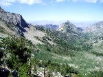
Box Canyon
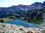
Lamoille and Dollar Lakes
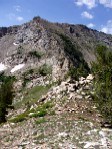
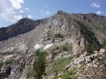
Two Views of Liberty Peak from the Ridge
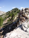
View from the Ridge Facing North
There is a small lake or pond, sometimes unofficially called Box Lake (for its location in Box Canyon) that is located some distance from the ridge and on the north side of Box Canyon. The lower left photo attempts to capture the lake on the shelf near the center of the photo. The center photo is the same lake taken from the pass between Kleckner and Box canyons. The lower right photo shows the pass.
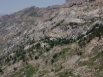
Box Lake from the Ridge

Box Lake from Kleckner Pass

Kleckner Pass
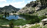
Close Up Photo of Box Lake from Within Box Canyon
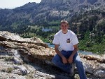 Mike and George at the Ridge
The return route from the ridge can be made by a straight down descent to Lamoille Lake if desired. There are no large rocks or willow patches in the way to navigate around but the hillside at this point is very steep, greater than 45 degrees, with the usual small to medium sized rocks and slippery footing. Two hiking poles are a must to maintain balance and minimize slipping and falling.
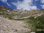
View Towrds Ridge after Descent to Lamoille Lake

Typically There are Hikers and Fishermen at Lamoille Lake
From Lamoille Lake take either the Hiker or Stock trail back to the parking lot. The Hiker trail is about a half mile longer but provides better scenery. The Hiker trail will pass by the two Dollar lakes.
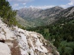
Parking Lot as Seen From Along the Trail
Return to top of Page (or scroll to next section)
LAMOILLE CANYON PHOTOS
© Lamoille Canyon Road 1930s, Lamoille Road 1950s and Lamoille Canyon Road 2000

© Former Mileage Sign Leading to Canyon (which has since been removed)
The Terraces is a picnic area on the left side of the road about two miles from the turnaround.
© Right Fork Lamoille Canyon and Massive Outcropping along Lamoille Canyon Road
©Views Across Lamoille Canyon from the Chute Leading to Ridge Above Verdi Lake
Return to top of Page (or scroll to next section)
LAKE NAME DIRECTORY
The following table lists all the named lakes in the Ruby Mountains and East Humboldts and identifies the pages of this site where information for each lake can be found.
| LAKES OF THE RUBY MOUNTAINS | - |
|---|
| LAKE NAME | SITE LOCATIONS |
|---|
Castle | Part 1 |
| Cold (2) | Parts 1, 2 Sup
, 3
|
| Dollar (2) | Part 1 |
| Echo | Parts 1, 2
, 3 Sup |
| Favre | Parts 1, 4 |
| Goat | Part 3 Sup |
| Griswold | Parts 2
, 2 Sup
|
| Hidden (2) | Parts 1, 2
, 2 Sup
, 3
|
| Island | Part 1 |
| Lamoille | Part 1 |
| Liberty | Parts 1, 2
, 3 Sup, 4 |
| Lost | Parts 1, 2
, 2 Sup
, 3 Sup |
| North Furlong | Parts 1, 5 |
| Overland | Parts 1, 2
, 3
, 4
, 5
|
| Robinson | Parts 2
, 2 Sup
, 3
|
| Seitz | Parts 2
, 2 Sup
|
| Soldier | Parts 2
, 2 Sup
, 3
|
| Verdi | Parts 1, 2
, 2 Sup
, 3 Sup |
| LAKES OF THE EAST HUMBOLDTS | - |
|---|
| LAKE NAME | SITE LOCATIONS |
|---|
Angel | Parts 1, 2
, 2 Sup
, 3
, 3 Sup |
| Birdeye | Parts 2
, 2 Sup, 5
|
| Boulder | Parts 1, 2
, 3
, 3 Sup, 5
|
| Greys | Parts 1, 2
, 3 Sup |
| Smith | Parts 1, 2, 5
|
| Steele | Parts 1, 2
, 3, 5
|
| Winchell | Parts 1, 2
, 2 Sup
, 3
|
Echo Lake takes top honors for size and depth at 29 acres and 155 feet in depth. Liberty Lake is second in both size and depth at 21 acres and 108 feet. Castle is the shallowest at five feet and Robinson Lake is not far behind at only six feet. Robinson Lake is located on a flat area rather than in a basin and this would account for the shallowness of the lake.
Both Echo and Liberty lakes have large Mackinaw trout.
Return to top of page (or scroll to next section)
NAME THOSE LAKES AND WIN $
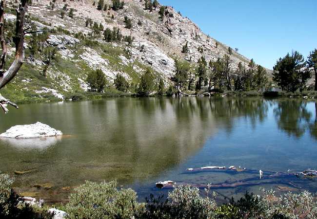
This is not your average giveaway extravaganza (it is far below average) but if you are a winner you can purchase a beverage of your choice, a movie for two, or even lunch for two. The three lake photos shown below are from the combined Ruby Mountains Wilderness and East Humboldt Wilderness Forest Service map that has been mentioned several times throughout these pages. Can you identify any of the lakes in the photos? It only costs an email stamp to try.
Identify one lake correctly, win $5; identify two lakes correctly, win $15; identify all three lakes correctly and win $25. The lakes are NOT identified on the Forest Service map, but different views of the lakes are shown throughout these pages. Include your name and mailing address and send your reply to:
Ruby Mountains Express. You will be informed of the results by email, and the check is in the other kind of mail for one or more correct answers.
_5$ winners to date: 5
15$ winners to date: 3
25$ winners to date: 1
Lake #1 identifications to date: 3
Lake #2 identifications to date: 8
Lake #3 identifications to date: 3
Return to top of Page (or scroll to next section)
TOPOGRAPHIC MAP SITE
Use Topozone to search for names of lakes, creeks and canyons that have been mentioned on these pages. Show the state as NV and if the place name is recognized, a listing of one or more possibilities will display. Select what appears to be the correct possibility (the correct location will be Elko county) and the feature will appear near the center of the resulting map and marked with a small red cross. The map can be displayed in small, medium or large size. The small size covers about 35 square miles while the large size covers around 200 square miles but with no loss in detail size. The topographic map pages are quite good and can be printed.
Return to top of Page (or scroll to next section)
 April 1996
Cover of April 1996 issue shows Lamoille Creek with Liberty Pass in background.
The magazine features a number of articles on entertainers, both past and present, in Vegas, Reno and Tahoe, but the real great stories are out of rural Nevada. Two favorites are about the Nevada haylift and the wreck of the City of San Francisco streamliner.

February 1999
OPERATION HAYLIFT (February 1999)
"The winter Nevada's ranchers faced their own cold war."
The winter of 1948/49 hit northern and eastern Nevada with a vengeance and brought more snow and dipping temperatures than the state had seen in years. Snowfall and snowdrifts piled higher and higher, roads could not be kept open, and it became impossible for ranchers to get feed to their livestock in the hills and on the open range. Elko and White Pine counties were the hardest hit.
Sheep and cattle were dying on their feet and emergency procedures were desperately needed. Nevada officials alerted Washington of the situation and President Truman authorized funds for the existing state of emergency. The Air Force furnished about 28 C-82 Flying Boxcars and, coordinated by Ely rancher George Swallow, Operation Haylift began. Usually accompanied by an area rancher, the C-82 pilots would locate stranded livestock and bails of hay were dropped nearby.
My friend Ken Hammond of Elko was recruited as a "pusher" and he worked hay drops in Ruby Valley. The pushers did just that, lashed inside the plane with ropes and harnesses to keep from falling out, they pushed the bails of hay out the open cargo doors. Ken reported that he was constantly nauseated and throwing-up because of the air turbulence and thousands of hay particles swirling around inside the aircraft.
Thousands of sheep and cattle did perish but Ken kept pushing and throwing-up and did his part in preventing the situation from becoming much worse which would have brought complete economic disaster to the area. Two thousand tons of hay were dropped during the haylift.

October 1997
MYSTERY OF THE CITY OF SAN FRANCISCO (October 1997)
"Was the famous train wreck of 1939 caused by speed or sabotage?"
Probably wondering what it was like to be inside, most people would stop and admire the yellow streamliner as the City of San Francisco roared through Elko at night without stopping. On the night of August 12, 1939 the train was about a half hour behind schedule as it pulled into Carlin, 25 miles west of Elko, to change crews. The new engineer is to have told the fireman that they would arrive in Oakland on time since they could throttle up to 90 mph across the Nevada flats. The train didn't make it to Oakland.
Fifteen minutes later, between Carlin and Beowawe, 24 people would die when the train jumped the track at a railroad bridge and fell into the Humboldt River with several cars stacked up and scattered around like match sticks. The engines and a few cars had made it over the bridge. Southern Pacific railroad officials immediately declared the derailment an act of sabotage, claiming that track spikes and bars connecting two rails had been removed and that the receiving rail had been moved inward about four inches and re-spiked. This claim of rail tampering was never proven.
The train crew claimed that they were traveling 60 mph at the time. S.P. detectives displayed two jackets that they said were found in the river, and, trying to suggest they had been dropped by the saboteurs, offered a $10,000 reward for "Whose Jackets are These?" Rancher Buck Bell reported however that while riding fence he had seen the jackets two weeks earlier and neither was in the river.
S.P. records are to have indicated that over 93,000 people were interviewed over the next six months. That figure seems absurd and would require interviewing 500 people a day, and would take in about the entire population of the state of Nevada at the time. No suspects were ever developed. S.P. officials stuck to the sabotage story while many others, including train survivors, contribute the derailment to excessive speed.
Link to Nevada Magazine web page for subscription information.
Return to top of Page (or scroll to next section)
NEVADA COWGIRLS

Nevada Cowgirls
Email correspondence to Ruby Mountains Express
I respond to all emails
George Sheaks
Ventura, CA
(Elko native)
Search This Site With: www.atomz.com to Identify Pages that Contain Subject Matter of Interest.
Use of the "Exact Phrase" option is usually recommended in order to avoid most non-relevant hits. Set Within: to 'Anywhere' in order to also include text captions on photos. Hits on the search terms will provide links to the page(s) where the text is located along with text summaries. The summaries should help identify the pages with the desired information.
The search engine identifies exact text (or almost exact text) and not concepts. For example, to find photos of North Furlong Lake (or anything else), do not search for 'photos of North Furlong Lake'. Instead, search for 'North Furlong Lake' which will identify pages containing that text and most or all identified pages will usually have the related photos.
Return to top of Page
Part 1, Trail to Liberty Pass and Beyond
Part 2, Other Wilderness Areas
Part 3, Outfitters and Pack Trips
Part 3 Supplement, Outfitters, Pack Trips, Thomas Canyon, Right Fork Canyon and Ruby Valley
Part 4, Hiking the Entire Ruby Crest Trail with Lynda Mellows and Rosanne Baker
Part 5, Birdeye Lake, Overland Lake, Lake Peak, Smith Lake, Clover Valley and Cave Creek
Part 6, Hiking Difficulty Comparison Chart
Part 7, C-47 and B-17 Military Aircraft Crash in the East Humboldt Mountain Range













 February 1999
  October 1997
